Monday 7th February
Today's contributor: Jon Copley
We've arrived at the East Scotia Ridge - and so has the weather.
On the way here, we stopped to deploy the CTD probe to collect a "background" sample away from any deep-sea vents. We needed at least 2500 metres of water depth for the deployment, to have a comparable depth to that at the ridge. But although our chart showed a large area deeper than 2500 m on the way here, we found it to be dotted with shallower seamounts - another example of how we still don't have an accurate map of two-thirds of our planet.
Since arriving at the ridge in the early hours, we have been using the CTD probe to collect samples from just above the vents that we found last year. The CTD can collect water in its Niskin bottles, and also carry pumps that filter particles from the water, for our geochemists and microbiologists to analyse.
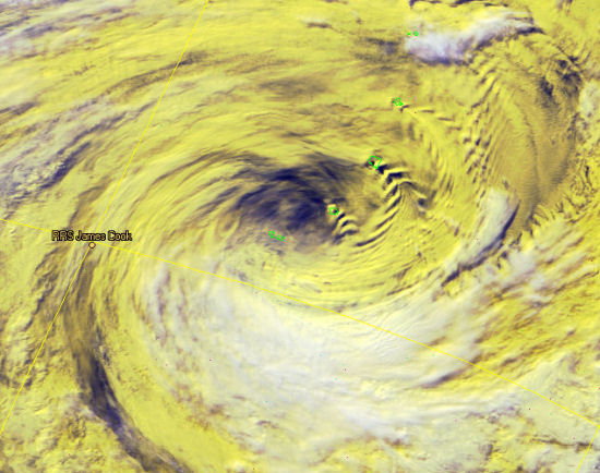
After a couple of CTD deployments, however, the weather worsened. So for the afternoon, we rode out a passing storm, as shown in the satellite image (incidentally, the small green outlines in the image show the South Sandwich Islands, which cast visible wakes the clouds as they whip past in the wind). Hopefully calmer weather is following, which will allow us to resume operations soon.
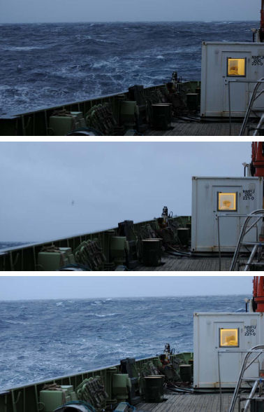
Photos by Paul Tyler of aft deck in swell;
at 3 second intervals: sea, sky, sea...